|
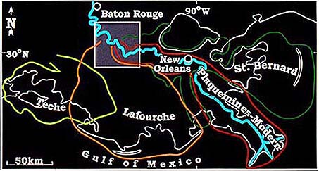
Following is an impression of fieldwork in the eastern Mississippi Delta, carried out during the period May-June 2001. Participants included Torbjörn Törnqvist, Juan González, and field assistants Greg Komperda, Shaunna Murray, and Yingjie Sun. The area we worked in during the 2000 and 2001 field seasons is located at the apex of three of the four late Holocene Mississippi River subdeltas: the St. Bernard, Lafourche, and Plaquemines-Modern. Starting in 2002, we have worked in the Teche subdelta, on the western margin of the Mississippi Delta.
The objective of the field research presented here was to unravel the Holocene sea-level history of the Mississippi Delta. This was part of a larger research program that focuses on the late Quaternary evolution of the Lower Mississippi River and adjacent Gulf Coast. Funding for the sea-level study is provided by NSF; a more extensive description of this project can be found elsewhere.
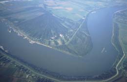 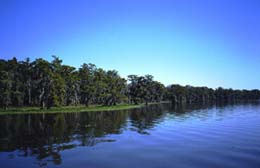
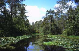
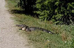
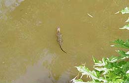
The landscape in this part of the world includes everything from incredible beauty to ecologic nightmare - much of the Mississippi River between Baton Rouge and New Orleans is bordered by petrochemical industry. Otherwise, the natural levees are covered by sugarcane fields, whereas the flood basins contain widespread swamps, loaded with wildlife.
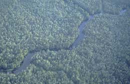 
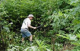
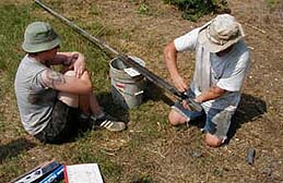
A considerable part of our type of fieldwork consists of hand drilling to study sedimentary successions, sometimes up to depths of 10-20 m. Sugarcane fields provide easy access and are ideal places to work in, but the best sea-level indicators are more often than not located in areas that are more hostile, like road shoulders in swamps. Under such conditions, a machete is indispensable to create a good drill site.
The premier field objective is to obtain so-called 'basal-peat' samples. Basal peats are the initial organic deposits that form on the consolidated Pleistocene basement as a result of relative sea-level rise and transgression during the Holocene. The underlying principle is that these basal peats were formed at an altitude close to contemporaneous mean sea level. The first stage of data collection consists of the drilling of cross sections in areas where basal peats cover a sloping basement. This should not be taken too literally; a cross section that has several meters of relief in the Pleistocene surface is already very useful since it enables us to cover a significant vertical interval of sea-level rise. Cross sections vary in length from hundreds of meters to several kilometers, and drilling distances can be as small as 5 m, depending on the nature of the subsurface.
A characteristic sedimentary succession is shown below, with grey, consolidated muds of the Pleistocene Prairie Complex, overlain by a darkgrey paleosol (A-horizon) that formed when the groundwater table was close to the land surface and organic matter could not anymore be entirely decomposed. Overlying that is the brown basal peat.
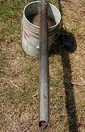
 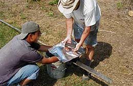
Juan González is carefully cutting out a basal-peat sample that has been collected with a 6-cm-diameter gouge. The sample is subsequently wrapped in aluminum foil and plastic, and kept in refrigerated storage prior to processing back in the laboratory. There, it will be sieved in order to extract plant macrofossils that are indicative of transgression, and can be 14C dated by AMS.
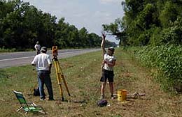
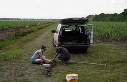
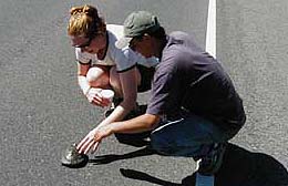
Because every sample represents a so-called 'sea-level index point', its altitude with respect to present mean sea level is just as important as its age. Elevation measurements in this area are complicated by the fact that reliable benchmarks are sparse. As a result, we have to cover long distances (up to 5 km) during surveys with an electronic total station. In order to obtain reliable benchmarks as close to our sample sites as possible, we use a differential Global Positioning System (GPS). This part of the investigation is carried out in conjunction with UNAVCO, Inc., in Boulder, Colorado. We spent three days in early June of 2001 collecting GPS data with the help of UNAVCO-colleagues Chuck Kurnik and Shad O'Neel and their equipment.
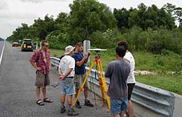
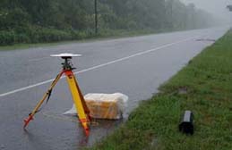 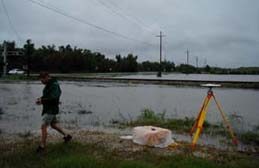
Right after the first receivers had been set up, tropical storm Allison visited the area, and over the next three days it dumped almost 20 inches of rain. Amazingly, it did not really harm the data collection, enabling us to nail down the altitude of our basal-peat samples with cm-accuracy with respect to present mean sea level.
Friends...
More friends...
|